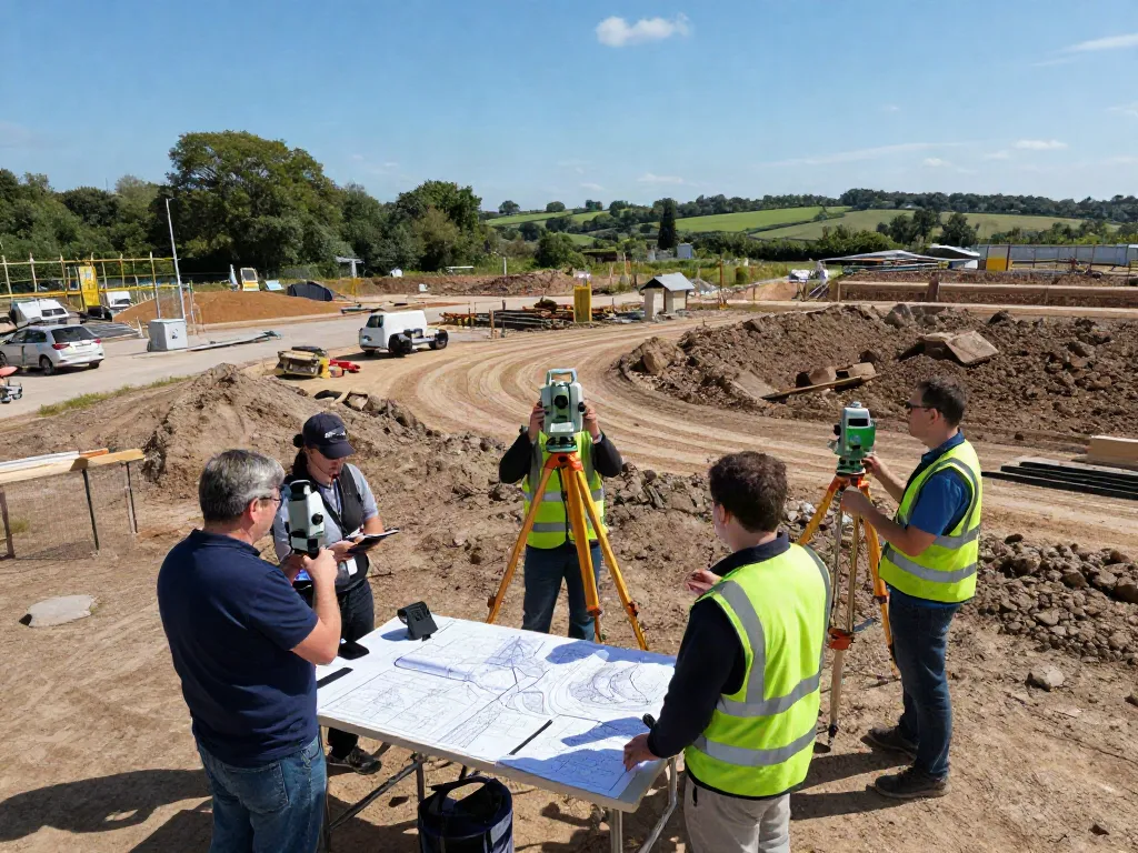
Understanding Topographical Surveys in Surrey
In the ever-evolving landscape of construction and land development, Topographical Survey Surrey plays a crucial role in ensuring that projects are grounded in accurate data. Topographical surveys provide detailed information about a land's natural and man-made features, presenting the contours, elevations, and other critical characteristics that guide construction, landscaping, and planning decisions. As urban areas like Surrey continue to develop, these surveys are indispensable for architects, engineers, and project managers seeking reliable data to inform their designs.
What is a Topographical Survey?
A topographical survey is a precise representation of a plot of land, highlighting its physical features. This includes the elevation, contours, and surface details that can impact construction and land use. Typically created through a combination of field measurements and GPS technology, topographical surveys present a comprehensive view of the terrain, which can be illustrated through detailed maps and 3D models. These surveys are essential for understanding how land interacts with various elements such as water drainage, vegetation, and existing structures.
Importance of Topographical Surveys in Construction
Topographical surveys are crucial in the construction process for several reasons:
- Project Planning: Providing essential data required for the initial planning phases of any construction project.
- Risk Management: Identifying potential challenges related to the land, such as slopes, water bodies, and existing structures that could complicate construction.
- Regulatory Compliance: Ensuring that the project adheres to legal requirements and zoning laws by providing necessary documentation.
- Cost Efficiency: Reducing the risk of costly design changes or construction delays caused by unforeseen site conditions.
Common Uses for Topographical Surveys in Surrey
In Surrey, topographical surveys are employed in a variety of applications, including but not limited to:
- Urban Development: Assisting city planners in understanding land use and optimizing urban layouts.
- Residential Construction: Providing homeowners and builders with necessary information for new home projects, extensions, or renovations.
- Infrastructure Projects: Supporting the design and construction of roads, bridges, and public facilities.
- Environmental Assessments: Helping in studies required for environmental impact assessments and landscape architecture.
The Process of Conducting a Topographical Survey
Preparation and Planning for Effective Surveys
The success of a topographical survey hinges on careful preparation. Surveyors must first assess the project requirements and gather information on the area to be surveyed. This often involves initial visits to the site, discussions with project stakeholders, and reviewing any existing documentation such as previous surveys or site plans. Clear communication during this stage lays the groundwork for a successful survey, ensuring that all necessary data will be captured effectively.
Techniques and Equipment Used for Topographical Surveys
Modern topographical surveying employs a range of sophisticated tools and technologies. Some of the key equipment includes:
- Total Stations: The primary device used for measuring angles and distances in the field.
- GPS Technology: Used for pinpointing exact locations and obtaining elevation data.
- 3D Laser Scanners: Providing rapid and highly detailed surveys of complex terrains.
- Drones: Increasingly used for aerial surveys, allowing surveyors to capture large areas quickly and efficiently.
Data Collection and Analysis
Once the survey is conducted, the collected data must be meticulously analysed. Surveyors use software to convert raw data into maps and 3D models, which must be accurate and user-friendly. This analysis enables planners and architects to make informed decisions based on visual representations of the terrain, ensuring that projects align with the landscape's natural features.
Choosing the Right Surveyor for Your Project
Key Qualities to Look for in a Topographical Surveyor
When selecting a topographical surveyor in Surrey, it is essential to consider several factors: professionalism, experience, and technological capabilities. Look for surveyors who have a proven track record in similar projects and who utilize the latest survey technology to ensure accuracy. Additionally, strong communication skills are vital, as they will help navigate any challenges that arise during the surveying process.
Questions to Ask Before Hiring
Before making a hiring decision, engage potential surveyors with specific questions to assess their suitability:
- What is your experience with similar projects?
- What surveying technology do you use?
- Can you provide references or case studies from previous clients?
- How do you handle unexpected challenges during a survey?
Comparing Costs and Services in Surrey
Understanding the cost of topographical surveys is crucial for effective budgeting. Prices can vary widely based on the project scale, complexity, and the technology used. When comparing quotes, consider not only the financial aspect but also the range of services offered. A slightly higher cost might be justifiable if it means greater accuracy and more comprehensive data.
Challenges in Topographical Surveying
Common Obstacles in Measuring Terrain Accurately
Surveying can be hindered by various obstacles, such as:
- Natural Features: Dense vegetation, water bodies, and rugged terrain can complicate data collection.
- Weather Conditions: Rain, fog, or snow can impair visibility and equipment functionality.
- Urban Obstacles: Existing buildings and infrastructure may block data collection.
How to Overcome Surveying Challenges
To mitigate these challenges, surveyors are employing advanced technologies and adaptive strategies. For example, drones can survey difficult-to-reach areas, while the use of total stations can streamline data collection in urban environments. Furthermore, conducting preliminary assessments can help identify potential issues before they affect the project timeline.
Technological Advances Improving Survey Accuracy
Technology is rapidly evolving in the surveying field, offering tools that enhance accuracy and efficiency. For instance, advancements in LiDAR technology allow for incredibly detailed terrain mapping, while software developments enable more effective data processing and visualisation. Staying abreast of these advancements is essential for surveyors aiming to provide top-notch services.
Future Trends in Topographical Surveying
Innovations to Watch in 2026
As we move into 2026, several innovations are set to reshape topographical surveying. Expect to see greater integration of artificial intelligence in data analysis and modelling, enabling surveyors to predict project challenges before they arise. Additionally, advancements in sensor technology will enhance the precision of data collection.
Impact of Drone Technology on Topographical Surveys
Drone technology continues to revolutionize topographical surveys. By providing aerial views of large areas, drones can capture data more quickly and accurately than traditional methods. Their ability to reach challenging terrains opens up new possibilities for surveying previously inaccessible locations.
Emerging Standards and Best Practices in the Industry
As technology evolves, so too do the standards and best practices within the surveying industry. Emerging trends include increased emphasis on sustainability and consideration for environmental impact during surveying. Additionally, there is a push for more transparent processes that enhance client trust in survey results.
How much does a topographical survey cost in the UK?
Costs for topographical surveys in the UK can vary widely, typically influenced by the size and complexity of the site. On average, smaller plots might range from £300 to £1,500, while larger, more complex sites could exceed £3,000. It's essential to obtain quotes from multiple providers to understand the market rate for your specific needs.
Why do I need a topographical survey?
A topographical survey is critical for determining the physical characteristics of a site, which informs land use decisions, construction planning, and design. This data ensures that projects are viable and comply with local regulations, ultimately helping prevent costly mistakes during construction.
How long does it take to complete a topo survey?
The duration of a topographical survey can vary based on several factors, including the site's size and the surveying methods used. Generally, a survey could take anywhere from a few days to several weeks. Early planning and efficient communication with your surveyor can help expedite the process.
What does a topographical survey include?
A comprehensive topographical survey encompasses a variety of data points, including ground elevation, contours, structures, and significant landscape features. This information is typically presented in both mapped and numerical formats, providing a complete overview of the survey area.
Can I conduct a topographical survey myself?
While it is technically possible for an individual to perform a basic topographical survey using GPS tools, professional expertise and equipment are highly recommended for precise results. Engaging a qualified surveyor ensures that the survey meets industry standards and provides reliable data for your project.